The United Nations has reported that Vietnam has finished submitting a map and a list detailing the geographic coordinates of key points related to the baseline used for calculating the width of its territorial sea within the Gulf of Tonkin.
|
|
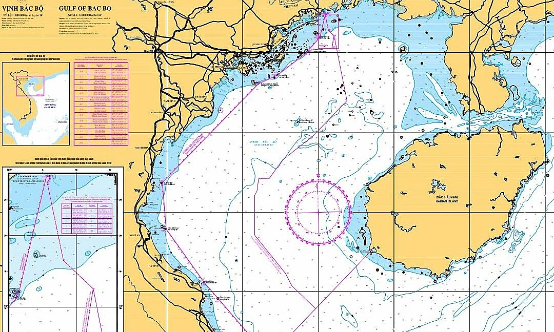
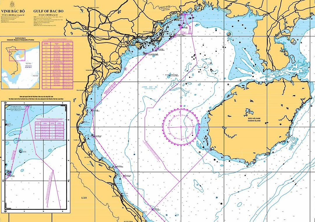
An image showing the standard used to gauge the width of Vietnam's territorial waters in the Gulf of Tonkin. The photo is provided courtesy of the United Nations. |
As per the communication from UN Secretary-General António Guterres to member states on March 12, 2025, Vietnam submitted to him on March 7, 2025, under Article 16, clause 2 of the 1982 United Nations Convention on the Law of the Sea (UNCLOS), charts depicting both the straight baselines and the external boundaries of its territorial waters. Additionally, Vietnam provided a compilation of geographical coordinate points used for determining the base lines from which the width of the territorial seas off mainland Vietnam in the Gulf of Tonkin is measured.
On March 14, the United Nations website released comprehensive details regarding Vietnam's submission. www.un.org/Depts/los .
The announcement further indicated that Vietnam's government statement from February 21, 2025, regarding the baselines used to measure the width of the territorial sea in the Gulf of Tonkin will be featured in an upcoming edition of the United Nations' "Law of the Sea Bulletin."


