Showing posts with label climatology. Show all posts

Un grand phénomène météorologique chamboule déjà le printemps en Belgique

Alors que le printemps ne fait que commencer, un phénomène météorologique atypique bouscule déjà les équilibres atmosphériques en Europe. Le vortex polaire, cette structure climatique de haute altitude, s’est désintégré de façon inhabituelle dès la fin mars.

Ce dérèglement entraîne un blocage de la circulation atmosphérique, avec des répercussions concrètes sur la météo en Belgique. Les conséquences s’annoncent préoccupantes, aussi bien pour les semaines à venir que pour la saison estivale.

Un phénomène stratosphérique souvent mal compris

Le terme « vortex polaire » est fréquemment utilisé dans les médias pour désigner l’arrivée d’air froid. Pourtant, sa signification scientifique est bien plus précise. Il désigne une zone de basses pressions située entre 10 et 50 kilomètres d’altitude dans la stratosphère, encerclée par un courant d’air puissant appelé le jet de la nuit polaire. Ce système agit comme un verrou qui maintient l’air froid confiné au niveau des pôles. Il ne faut pas le confondre avec le Jet Stream, qui se forme plus bas, dans la troposphère, et influence plus directement la météo à la surface.

La désintégration du vortex polaire n’est pas un événement anodin. Elle provoque une rupture dans les schémas de circulation de l’air, ouvrant la voie à des blocages atmosphériques durables. Cette année, ce phénomène s’est produit deux à trois semaines plus tôt qu’en moyenne. Selon le climatologue Xavier Fettweis, cette rupture entraîne un arrêt de la dynamique ouest-est classique des perturbations en Belgique; a relaté Sudinfo . Les systèmes météorologiques restent figés, pris dans une circulation désormais quasi inexistante. C’est cette immobilité qui pose un problème : en l’absence de mouvements d’air, les conditions météo deviennent répétitives et extrêmes.

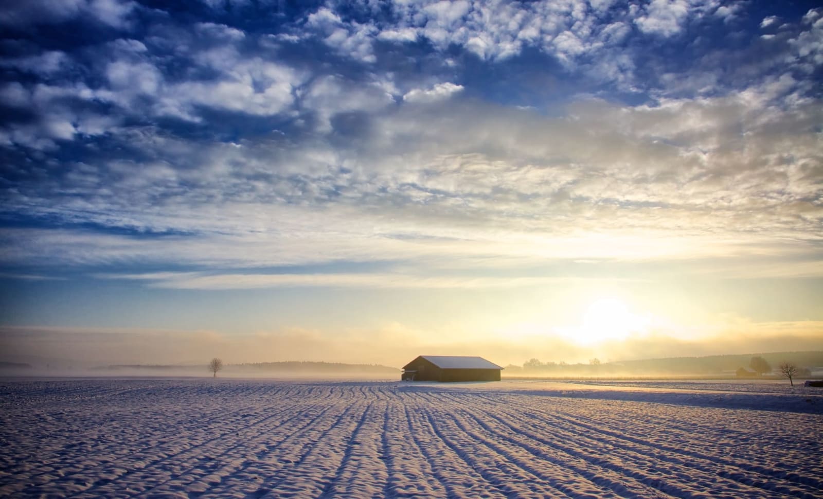
Depuis plusieurs semaines, un anticyclone s’est installé durablement sur l’Europe occidentale. Il empêche l’arrivée de perturbations et favorise un temps sec et stable. Cette situation, décrite comme un véritable « blocage atmosphérique », pourrait perdurer. À court terme, elle expose la Belgique à une double menace : des gelées tardives et une sécheresse précoce.

Des risques accrus pour l’agriculture et un été sous haute surveillance

Les conséquences de ce cas se manifestent déjà. mois de mars 2025 S'est achevé en raison d'un important manque d'eau. Selon les constatations récentes, aucun mieux-être n'est anticipé dans le futur proche. Des conditions météo anticycloneennes empêchent les pluies et aggravent la sècheresse du sol. Xavier Fettweis souligne que la situation pose problème pour l'agriculture : les nouvelles plantations exigent maintenant une irrigation précoce, ce qui est généralement peu courant à cette époque de l'année.

Parallèlement, l'arrivée de masses d'air froid venant du nord pourrait engendrer des gelées tardives. Ces dernières constituent une menace immédiate pour les pommiers, les vignobles ainsi que les cultures saisonnières. Le danger est davantage accru dans les régions rurales, où la baisse des températures pendant la nuit se fait sentir bien plus vite. Une gelée au mois d'avril pourrait causer des dommages importants, comme ce qui s'est produit durant des années analogues.

D'ici à plus long terme, cet écart atmosphérique pourrait influencer la dynamique saisonnière de l'été. Sans humidité présente dans les sols durant le printemps, l’énergie solaire ne sert plus à faire disparaître l'eau par vaporisation, elle se convertit en chaleur sensible, ce qui fait monter les thermomètres. Ce phénomène n'est pas ignoré par les scientifiques du climat, qui craignent qu'en 2025 nous ne retrouvions une situation similaire à celle observée durant l'été 2022, caractérisée par une sécheresse intense ainsi que des pics de température record. En cas de confirmation de cette tendance, la Belgique risque d'affronter un été extrêmement torride, voir carrément caniculaire.

De plus, il est encore incertain que la circulation atmosphérique retrouve un jour son état normal. La conduite du vortex polaire, élément central de cette perturbation, demeure imprévisible. À ce stade, aucun indice ne suggère un rétablissement rapide vers des conditions météo plus stables. Pendant ce temps, en parallèle, les responsables et les fermiers doivent être prêts à faire face à une phase complexe caractérisée par le déficit hydrique et des vagues de froid intempestives.

Avez-vous apprécié cet article? Inscrivez-vous à notre Infolettre gratuite Pour des articles fascinants, un contenu unique et les informations les plus récentes.

Pour davantage d’informations similaires, consultez DIWIDA.News

NASA Reports Unexpected Surge in Sea Levels Globally in 2024

In 2024, which has been recorded as the warmest year ever, sea levels have escalated beyond expectations, as reported by NASA. This rise can be linked to exceptionally elevated seawater temperatures along with the thawing of glaciers.

This increase is attributed to climate change caused by human activities, with rising temperatures on Earth causing higher sea levels because of greenhouse gases being released into the atmosphere.

NASA stated that based on satellite data, sea levels climbed by 0.59 centimeters in 2024, exceeding the forecasted figure of 0.43 centimeters. In the last thirty years, sea levels have gone up by 10 centimeters. While the primary cause remains the thawing of glaciers and ice sheets, one-third of this increment in 2024 can be attributed to the heat-induced expansion of ocean water as global temperatures soared.

Specialists forecast that sea levels will keep increasing, posing risks to coastal areas and islands.

The post NASA reports higher-than-anticipated sea level increases in 2024. appeared first on English - Morocco News .

Winter Ice Path Vanishes for 7 Years: Is Global Warming to Blame?

SUWA, Nagano — For the seventh consecutive winter, the natural occurrence known as "Omiwatari" has failed to materialize on Lake Suwa in Nagano Prefecture. This phenomenon involves ice formation on the lake’s surface splitting into a pattern resembling mountain ranges. Experts suggest that climate change might be contributing to this absence.

Based on records dating back to the Muromachi era (from 1336 to 1573), the frequency of winters lacking the "ake no umi" phenomenon has significantly increased since 1951. Kiyoshi Miyasaka, the 74-year-old head priest at Yatsurugi Shrine located in the city of Suwa within the prefecture, noted that "The effects of climate change and global warming are clearly visible on the lake."

It is said that according to legend, Omiwatari was the path taken by Takeminakata, the male deity of Kamisha Shrine within the Suwa Taisha shrine complex in Suwa, when he visited the goddess Yasakatome at her shrine, Shimosha Shrine, located in the nearby town of Shimosuwa. Because of this, it is often referred to as the “divine path of love.”

Miyasaka states that the Omiwatari was initially documented in 1397. These records were preserved in documents handed down through the Moriya family, who formerly led the Kamisha Shrine of Suwa Taisha. Following a temporary halt, annual documentation began again in 1443 during the middle Muromachi period, marking this as the 583rd instance of recording whether it occurred or not.

Over eight decades, from 1936 onwards—accounting for five missing years—"Ake No Umi" has taken place 81 times. Since 1951 specifically, within this 75-year span, it has happened 40 times. Notably, after the year 2000, this occurrence seems to be less frequent; out of these recent years, only 18 experienced the Omiwatari phenomenon. Importantly, it hasn’t appeared again since Japan transitioned into the Reiwa era in 2019. Concerned about this trend, Miyasaka remarked, “The traditional sights of Lake Suwa we’ve known might vanish soon. Soon enough, ‘Omiwatari’ could merely remain a legendary memory.”

This year also saw a scarcity of extremely cold days. On January 20, at a weather station located on the southern shore of the lake—a time typically considered the coldest day of the year in Japan—the thermometer read 3.2 degrees Celsius for the water temperature and zero degrees Celsius for the air. These figures matched those usually recorded around late March. Despite a frigid spell from February 9-10 causing temperatures to drop to -10°C, leading to widespread freezing across most of the lake’s surface, significant portions thawed again the following day. As forecasts did not predict additional cold fronts, officials termed this season an “akénoumi.”

On February 15th, Miyasaka announced the absence of an Omiwatari at his shrine. However, he cheerfully remarked afterwards, "Even though we didn’t have the Omiwatari this time, it’s invigorating to feel that spring has arrived."

The Ake no Umi Winters took place over the most extended consecutive duration of eight winters from 1507 to 1514, which falls within the Sengoku (Warring States) era of the late fifteenth and early sixteenth centuries. During this period, each year’s absence of Omiwatari was briefly documented in contemporary records. This prolonged sequence ranks as the second-longest; the next longest series spans six winters, occurring continuously from 1992 to 1997.

Miyasaka hypothesized that the eight-year gap occurred during the tumultuous times of war, suggesting it might not have been an appropriate moment for the ceremony. He further commented, “Considering this as the second longest interval, we should contemplate the impacts of global warming. Often, people view climate change as though it’s happening far away from them; however, we must acknowledge that even our own Lake Suwa is undergoing transformations—such changes are evident through the absence of ice cover on the lake. My wish is for everyone to reflect upon these findings.”

(Japanese original by Kazunori Miyasaka)