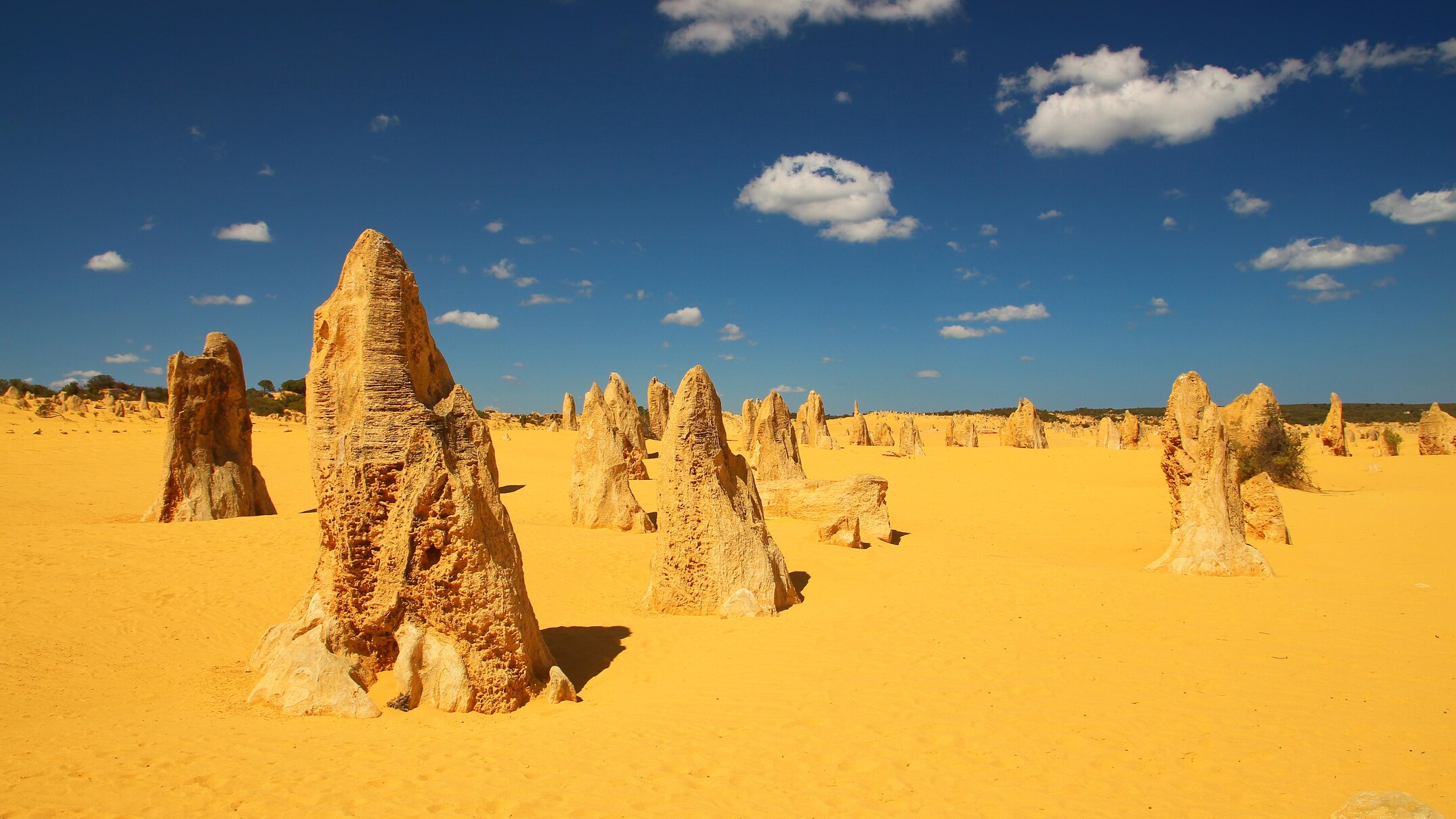
To be amidst the towering limestone formations and ever-changing golden dunes of the Pinnacles Desert feels akin to standing on an alien world.
The Yued people from the area they refer to as "Kwong-kan" (sandy place) believe that these rocks symbolize the hands and fingers of warriors who were consumed by the desert after defying their elders and trespassing into a forbidden zone.
For many years, Western scientists have been discussing the timing and reasons behind the formation of the "Pinnacles," with dates proposed as far back as 25,000 years ago and extending beyond 200,000 years.
A recent study, featured in the journal Science Advances indicates that the majority of these impressive geological formations were sculpted approximately 100,000 years ago into the pillar-like structures visible today, some reaching heights of up to 5 meters with widths of around 2 meters.
According to Matej Lipar, the lead author of the study from the Slovenian Academy of Sciences and Arts, The Pinnacles are remnants of a larger block of limestone that gradually eroded away over time.
His collaborator from Curtin University, geologist Milo Barham, compared the stone formation to "Swiss cheese," noting that the cavities became so extensive that only the Pinnacles remained.
Dr Barham mentioned that the main difficulty for the researchers was figuring out how to examine an object that had been taken away.
What methods would you use to determine when something vanished?
[map]Iron nodules provide dates
Located approximately two hours' drive north of Perth, The Pinnacles can be found along the world's longest stretch of coastal limestone. This formation extends about 1,000 kilometers from Shark Bay in the northwest almost to Albany in the south.
The extensive belt is referred to as the Tamala Limestone, which formed more than 2 million years ago.
Limestone, formed from seashells and sand deposited on shores long ago, is notably vulnerable to erosion and readily dissolves upon contact with substances like carbonic acid, often found in rainfall.
The leftover terrain is referred to as karst, which describes regions made up of eroded limestone or other minerals like gypsum and dolomite.
To determine when the Pinnacles were formed, the scientists examined other geochemical reactions that occurred during the dissolution of the limestone.
"Many people in Western Australia will recognise the red hues of the landscape, which is due to the iron content in the rocks," Dr Barham explained.
As the limestone in the region dissipated, Dr Lipar explained that iron-rich mineral nodules developed within the Pinnacles themselves.
"They are very tiny, which is why most people usually do not even see them," he explained.
The scientists determined the age of the iron nodules employing a technique known as U-Th/He dating. This approach gauges the buildup of helium atoms resulting from the radioactive decay of uranium and thorium.
Based on their findings, the scientists determined that approximately 102,000 years ago, there was an exceptionally humid phase lasting several millennia which caused the dissolution of the limestone, thus giving rise to the formation of the Pinnacles.
Although many of the columns at the Pinnacles are connected at the bottom Additionally, there are some features that seem to have been created through an alternative mechanism, with sand filling in areas where cavities had been dissolved away.
Mysteries remain
Although scientists might possess greater knowledge about the formation period of the Pinnacles, precisely why every pillar remained intact as the surrounding limestone eroded continues to be difficult to determine.
Doctor Barham mentioned that he believed, in certain cases, the creation of spires could potentially be attributed to random chance, based on the initial positioning of openings within the limestone.
He asked, 'Was there perhaps some kind of framework overhead that prevented water from entering that section of limestone?'
Here are a few points we probably still need to uncover. The Pinnacles hold numerous mysteries for us to delve into.
Dr Lipar mentioned that if iron nodules are found in comparable karst areas worldwide, these could also serve as dating tools for those locations, thereby providing greater insights into Earth’s historical climates.
He mentioned areas such as the Caribbean, along with the Mediterranean islands and coastlines… and South Australia, where all structures are built from comparable rocks.


